National Register of Historic Places listings in King and Queen County, Virginia

This is a list of the National Register of Historic Places listings in King and Queen County, Virginia.
This is intended to be a complete list of the properties and districts on the National Register of Historic Places in King and Queen County, Virginia, United States. The locations of National Register properties and districts for which the latitude and longitude coordinates are included below, may be seen in an online map.[1]
There are 17 properties and districts listed on the National Register in the county.
This National Park Service list is complete through NPS recent listings posted July 5, 2024.[2]
Map all coordinates using OpenStreetMap
Download coordinates as:
- KML
- GPX (all coordinates)
- GPX (primary coordinates)
- GPX (secondary coordinates)
Current listings
| [3] | Name on the Register[4] | Image | Date listed[5] | Location | City or town | Description |
|---|---|---|---|---|---|---|
| 1 | Bewdley |  | November 16, 1978 (#78003024) | South of St. Stephens Church on the Mattaponi River 37°45′06″N 77°03′53″W / 37.751528°N 77.064722°W / 37.751528; -77.064722 (Bewdley) | St. Stephens Church | |
| 2 | Bruington Rural Historic District |  | March 11, 2019 (#100003481) | Along Rose Mount Rd., Pea Ridge Rd., The Trail, Bruington Rd., and Norwood Rd. 37°46′36″N 76°59′30″W / 37.776667°N 76.991667°W / 37.776667; -76.991667 (Bruington Rural Historic District) | Bruington | |
| 3 | Dixon |  | January 20, 2005 (#04001539) | 402 Limehouse Rd. 37°35′01″N 76°47′29″W / 37.583611°N 76.791389°W / 37.583611; -76.791389 (Dixon) | Shacklefords | |
| 4 | Farmington |  | March 17, 1995 (#95000243) | 1.5 miles (2.4 km) southeast of the junction of U.S. Route 360 and State Route 14 37°46′44″N 77°02′13″W / 37.778889°N 77.036944°W / 37.778889; -77.036944 (Farmington) | St. Stephens Church | |
| 5 | Fort Mattapony |  | August 19, 1994 (#94000547) | By the cemetery at Locust Grove Plantation[6] 37°43′45″N 77°00′42″W / 37.729167°N 77.011667°W / 37.729167; -77.011667 (Fort Mattapony) | Walkerton | |
| 6 | Hillsborough |  | September 22, 1971 (#71000984) | 2 miles (3.2 km) southeast of Walkerton off Walkerton Landing Rd. 37°42′36″N 76°59′00″W / 37.710000°N 76.983333°W / 37.710000; -76.983333 (Hillsborough) | Walkerton | |
| 7 | Holly Hill | 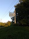 | July 24, 1973 (#73002026) | Northeast of Aylett off U.S. Route 360 37°47′41″N 77°05′04″W / 37.794722°N 77.084444°W / 37.794722; -77.084444 (Holly Hill) | Aylett | |
| 8 | King and Queen Courthouse Green Historic District | 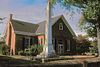 | September 24, 1998 (#98001162) | Junction of Allen Circle and Courthouse Landing Rd., northwest of Shacklefords; also 106 Allen Circle 37°40′10″N 76°52′41″W / 37.669444°N 76.878056°W / 37.669444; -76.878056 (King and Queen Courthouse Green Historic District) | Shacklefords | 106 Allen Circle represents a boundary increase of February 5, 2014 |
| 9 | Marriott School |  | February 13, 2007 (#07000052) | 450 Newtown Rd. 37°48′28″N 77°03′15″W / 37.807778°N 77.054167°W / 37.807778; -77.054167 (Marriott School) | St. Stephens Church | Houses the King and Queen County branch of the Pamunkey Regional Library |
| 10 | Mattaponi Church |  | March 20, 1973 (#73002027) | ½ mile south of Cumnor off State Route 14 37°43′08″N 76°53′13″W / 37.718889°N 76.886944°W / 37.718889; -76.886944 (Mattaponi Church) | Cumnor | |
| 11 | Millers Tavern Rural Historic District |  | June 5, 2017 (#100001040) | Roughly bounded by U.S. Route 360 and Howerton, Dunbrooke, Latanes Mill, and Midway Rds. 37°49′43″N 76°57′02″W / 37.828611°N 76.950556°W / 37.828611; -76.950556 (Millers Tavern Rural Historic District) | Millers Tavern | Extends into Essex County |
| 12 | Chief Otho S. and Susie P. Nelson House | Upload image | August 8, 2019 (#100004262) | Address Restricted | Indian Neck vicinity | |
| 13 | Newington Archaeological Site | 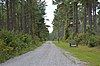 | March 31, 2010 (#10000146) | 697 Frazier Ferry Rd. 37°40′20″N 76°54′12″W / 37.672222°N 76.903333°W / 37.672222; -76.903333 (Newington Archaeological Site) | King and Queen Courthouse | |
| 14 | Newtown Historic District |  | October 29, 1982 (#82001821) | Newtown and Byrd's Mill Rds. 37°54′48″N 77°07′41″W / 37.913333°N 77.128056°W / 37.913333; -77.128056 (Newtown Historic District) | Newtown | |
| 15 | Northbank |  | March 7, 2006 (#06000121) | 453 N. Bank Rd. 37°45′56″N 77°04′28″W / 37.765556°N 77.074444°W / 37.765556; -77.074444 (Northbank) | Walkerton | |
| 16 | Providence Plantation and Farm |  | September 3, 2009 (#09000689) | 1302 Roundabout Route Rd. 37°54′56″N 77°10′35″W / 37.915556°N 77.176389°W / 37.915556; -77.176389 (Providence Plantation and Farm) | Newtown | |
| 17 | Upper Church, Stratton Major Parish |  | April 2, 1973 (#73002030) | Southeast of Shanghai on State Route 14 37°36′10″N 76°46′15″W / 37.602778°N 76.770833°W / 37.602778; -76.770833 (Upper Church, Stratton Major Parish) | Shanghai |
See also
Wikimedia Commons has media related to National Register of Historic Places in King and Queen County, Virginia.
- List of National Historic Landmarks in Virginia
- National Register of Historic Places listings in Virginia
References
- ^ The latitude and longitude information provided in this table was derived originally from the National Register Information System, which has been found to be fairly accurate for about 99% of listings. Some locations in this table may have been corrected to current GPS standards.
- ^ National Park Service, United States Department of the Interior, "National Register of Historic Places: Weekly List Actions", retrieved July 5, 2024.
- ^ Numbers represent an alphabetical ordering by significant words. Various colorings, defined here, differentiate National Historic Landmarks and historic districts from other NRHP buildings, structures, sites or objects.
- ^ "National Register Information System". National Register of Historic Places. National Park Service. April 24, 2008.
- ^ The eight-digit number below each date is the number assigned to each location in the National Register Information System database, which can be viewed by clicking the number.
- ^ Linebaugh, Donald W. Written Historical and Descriptive Data: Walkerton Bridge. Washington: Historic American Engineering Record (National Park Service), n.d., 4. Accessed 2013-09-27.
- v
- t
- e
by county
- Accomack
- Albemarle
- Alleghany
- Amelia
- Amherst
- Appomattox
- Arlington
- Augusta
- Bath
- Bedford
- Bland
- Botetourt
- Brunswick
- Buchanan
- Buckingham
- Campbell
- Caroline
- Carroll
- Charles City
- Charlotte
- Chesterfield
- Clarke
- Craig
- Culpeper
- Cumberland
- Dickenson
- Dinwiddie
- Essex
- Fairfax
- Fauquier
- Floyd
- Fluvanna
- Franklin
- Frederick
- Giles
- Gloucester
- Goochland
- Grayson
- Greene
- Greensville
- Halifax
- Hanover
- Henrico
- Henry
- Highland
- Isle Of Wight
- James City
- King and Queen
- King George
- King William
- Lancaster
- Lee
- Loudoun
- Louisa
- Lunenburg
- Madison
- Mathews
- Mecklenburg
- Middlesex
- Montgomery
- Nelson
- New Kent
- Northampton
- Northumberland
- Nottoway
- Orange
- Page
- Patrick
- Pittsylvania
- Powhatan
- Prince Edward
- Prince George
- Prince William
- Pulaski
- Rappahannock
- Richmond
- Roanoke
- Rockbridge
- Rockingham
- Russell
- Scott
- Shenandoah
- Smyth
- Southampton
- Spotsylvania
- Stafford
- Surry
- Sussex
- Tazewell
- Warren
- Washington
- Westmoreland
- Wise
- Wythe
- York

by city
- Alexandria
- Bristol
- Buena Vista
- Charlottesville
- Chesapeake
- Colonial Heights
- Covington
- Danville
- Emporia
- Fairfax
- Falls Church
- Franklin
- Fredericksburg
- Galax
- Hampton
- Harrisonburg
- Hopewell
- Lexington
- Lynchburg
- Manassas
- Manassas Park
- Martinsville
- Newport News
- Norfolk
- Norton
- Petersburg
- Poquoson (no listings)
- Portsmouth
- Radford
- Richmond
- Roanoke
- Salem
- Staunton
- Suffolk
- Virginia Beach
- Waynesboro
- Williamsburg
- Winchester
Municipalities and communities of King and Queen County, Virginia, United States | ||
|---|---|---|
County seat: King and Queen Court House | ||
| CDP |  | |
| Unincorporated communities |
| |
| Footnotes | ‡This populated place also has portions in an adjacent county or counties | |
| ||


