National Register of Historic Places listings in Highland County, Virginia

This is a list of the National Register of Historic Places listings in Highland County, Virginia.
This is intended to be a complete list of the properties and districts on the National Register of Historic Places in Highland County, Virginia, United States. The locations of National Register properties and districts for which the latitude and longitude coordinates are included below, may be seen in an online map.[1]
There are 8 properties and districts listed on the National Register in the county.
This National Park Service list is complete through NPS recent listings posted July 5, 2024.[2]
Map all coordinates using OpenStreetMap
Download coordinates as:
- KML
- GPX (all coordinates)
- GPX (primary coordinates)
- GPX (secondary coordinates)
Current listings
| [3] | Name on the Register[4] | Image | Date listed[5] | Location | City or town | Description |
|---|---|---|---|---|---|---|
| 1 | Crab Run Lane Truss Bridge |  | September 16, 2009 (#09000728) | Mansion House Rd. over Crab Run 38°20′07″N 79°29′24″W / 38.335278°N 79.490000°W / 38.335278; -79.490000 (Crab Run Lane Truss Bridge) | McDowell | |
| 2 | GW Jeep Site |  | December 23, 1993 (#93001443) | Elleber Sods Rd.[6] 38°24′55″N 79°42′25″W / 38.415278°N 79.706944°W / 38.415278; -79.706944 (GW Jeep Site) | Monterey | Extends into Pocahontas County, West Virginia |
| 3 | C.P. Jones House and Law Office |  | December 24, 2013 (#13000989) | 144 and 160 W. Main St. 38°24′47″N 79°34′55″W / 38.413056°N 79.581806°W / 38.413056; -79.581806 (C.P. Jones House and Law Office) | Monterey | |
| 4 | Mansion House |  | January 31, 2006 (#05001619) | 161 Mansion House Rd. 38°20′12″N 79°29′30″W / 38.336667°N 79.491528°W / 38.336667; -79.491528 (Mansion House) | McDowell | |
| 5 | McClung Farm Historic District |  | January 25, 1991 (#90002195) | Bullpasture River Rd.[7] 38°16′11″N 79°32′31″W / 38.269722°N 79.541944°W / 38.269722; -79.541944 (McClung Farm Historic District) | McDowell | |
| 6 | McDowell Presbyterian Church | 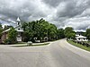 | February 19, 2020 (#100004979) | 9090 Highland Tpk. 38°19′55″N 79°29′19″W / 38.3320°N 79.4886°W / 38.3320; -79.4886 (McDowell Presbyterian Church) | McDowell vicinity | |
| 7 | Monterey High School |  | March 13, 2002 (#02000178) | Spruce St., 0.5 miles south of U.S. Route 250 38°24′36″N 79°35′12″W / 38.410000°N 79.586667°W / 38.410000; -79.586667 (Monterey High School) | Monterey | |
| 8 | Monterey Hotel |  | January 18, 1974 (#74002130) | Main St. (U.S. Route 250) 38°24′46″N 79°34′50″W / 38.412778°N 79.580556°W / 38.412778; -79.580556 (Monterey Hotel) | Monterey |
See also
Wikimedia Commons has media related to National Register of Historic Places in Highland County, Virginia.
- List of National Historic Landmarks in Virginia
- National Register of Historic Places listings in Virginia
References
- ^ The latitude and longitude information provided in this table was derived originally from the National Register Information System, which has been found to be fairly accurate for about 99% of listings. Some locations in this table may have been corrected to current GPS standards.
- ^ National Park Service, United States Department of the Interior, "National Register of Historic Places: Weekly List Actions", retrieved July 5, 2024.
- ^ Numbers represent an alphabetical ordering by significant words. Various colorings, defined here, differentiate National Historic Landmarks and historic districts from other NRHP buildings, structures, sites or objects.
- ^ "National Register Information System". National Register of Historic Places. National Park Service. April 24, 2008.
- ^ The eight-digit number below each date is the number assigned to each location in the National Register Information System database, which can be viewed by clicking the number.
- ^ Brinker, Ruth. National Register of Historic Places Inventory-Nomination Form: GW Jeep Site. National Park Service, 1992-08-31, 9.
- ^ Frazler, William T., and Nancy Born. National Register of Historic Places Inventory/Nomination: McClung Farm Historic District. National Park Service, 1990-03, 16.
- v
- t
- e
by county
- Accomack
- Albemarle
- Alleghany
- Amelia
- Amherst
- Appomattox
- Arlington
- Augusta
- Bath
- Bedford
- Bland
- Botetourt
- Brunswick
- Buchanan
- Buckingham
- Campbell
- Caroline
- Carroll
- Charles City
- Charlotte
- Chesterfield
- Clarke
- Craig
- Culpeper
- Cumberland
- Dickenson
- Dinwiddie
- Essex
- Fairfax
- Fauquier
- Floyd
- Fluvanna
- Franklin
- Frederick
- Giles
- Gloucester
- Goochland
- Grayson
- Greene
- Greensville
- Halifax
- Hanover
- Henrico
- Henry
- Highland
- Isle Of Wight
- James City
- King and Queen
- King George
- King William
- Lancaster
- Lee
- Loudoun
- Louisa
- Lunenburg
- Madison
- Mathews
- Mecklenburg
- Middlesex
- Montgomery
- Nelson
- New Kent
- Northampton
- Northumberland
- Nottoway
- Orange
- Page
- Patrick
- Pittsylvania
- Powhatan
- Prince Edward
- Prince George
- Prince William
- Pulaski
- Rappahannock
- Richmond
- Roanoke
- Rockbridge
- Rockingham
- Russell
- Scott
- Shenandoah
- Smyth
- Southampton
- Spotsylvania
- Stafford
- Surry
- Sussex
- Tazewell
- Warren
- Washington
- Westmoreland
- Wise
- Wythe
- York

by city
- Alexandria
- Bristol
- Buena Vista
- Charlottesville
- Chesapeake
- Colonial Heights
- Covington
- Danville
- Emporia
- Fairfax
- Falls Church
- Franklin
- Fredericksburg
- Galax
- Hampton
- Harrisonburg
- Hopewell
- Lexington
- Lynchburg
- Manassas
- Manassas Park
- Martinsville
- Newport News
- Norfolk
- Norton
- Petersburg
- Poquoson (no listings)
- Portsmouth
- Radford
- Richmond
- Roanoke
- Salem
- Staunton
- Suffolk
- Virginia Beach
- Waynesboro
- Williamsburg
- Winchester
Municipalities and communities of Highland County, Virginia, United States | ||
|---|---|---|
County seat: Monterey | ||
| Town |  | |
| CDP | ||
| Other communities | ||
| Footnotes | ‡This populated place also has portions in an adjacent county or counties | |
| ||


