Wild Basin Wilderness Preserve
Nature preserve near Austin, Texas
30°18′37″N 97°49′24″W / 30.31028°N 97.82333°W / 30.31028; -97.82333St. Edward's University
Wild Basin Wilderness Preserve consists of 227 acres (919,000 m2) of native Texas Hill Country habitat west of Austin, Texas in West Lake Hills. The preserve was founded in 1974 by seven women who were members of an environmentalist group called Now or Never, and it was Austin's first nature preserve.[1] The preserve maintains 2.5 miles (4 km) of hiking trails.
Location
The entrance to the preserve is a mile north of Bee Caves Road along the east side of Loop 360. The hiking trails are open every day sunrise to sunset, usually this is in between the hours of 7am-7pm. The Wild Basin Creative Research Visitor Center is open M-F, 9am-4pm.[2]
Bikes, pets, smoking and picnics are all prohibited within the preserve boundaries.[2]
The preserve serves as a gateway to the larger Balcones Canyonlands Preserve.[1]
History
In 1974 Janet Poage, a West Lake Hills resident and prominent environmentalist, was instrumental in negotiating a developments rights agreement between the City of Austin, Travis County, and Westview Development creating the preserve. Other founders include Margaret Hessin, Lucille Stegman, Flora (Esther) McCormick, Florence Macklin, Martha Hudson, and Willa Mae Hardesty. [1]
Mrs. Poage along with Westview executive Beth Robertson, Mayor Carol McClellan and County Commissioner Ann Richards redrew the master plan of Westview's 1,300-acre Davenport Ranch residential development in order to set aside over 100 acres of the developer's land to protect the sensitive Hill Country environment including habitat for the endangered black-capped vireo and golden-cheeked warbler.
In the deal, Westview donated the land to Wild Basin and, in return, the City gave the developer the right to relocate 100 residential units originally planned on the preserve land to its adjacent property. This transaction was one of the first transfers of development rights in the Austin area and created one of the more important environmental laboratories on the Edwards Plateau.
References
- ^ a b c "About Wild Basin | St. Edward's University in Austin, Texas". www.stedwards.edu. Retrieved 2022-04-11.
- ^ a b "Visiting the Preserve | St. Edward's University in Austin, Texas". www.stedwards.edu. Retrieved 2022-04-11.
External links
Wikimedia Commons has media related to Wild Basin Wilderness Preserve.
- Official website
- St. Edward’s University Wild Basin Creative Research Center official site
- v
- t
- e
Austin, Texas
Slogan: Live Music Capital of the World
- Austin Zoo
- Circuit of the Americas
- Darrell K Royal–Texas Memorial Stadium
- Dell Diamond
- Driskill Hotel
- Frank Erwin Center
- NLand
- State Capitol
- Texas Governor's Mansion
- Treaty Oak
- UFCU Disch-Falk Field
- University of Texas Tower
- Zach Theatre
- 1839 city plan
- 1928 city plan
- Austin Dam failure
- Capitol View Corridors
- COVID-19 pandemic
- French Legation
- Greater Austin
- Stephen F. Austin
- Texas Archive War
- Timeline
- Treaty Oak
- Waterloo, Texas
| Tertiary | |||
|---|---|---|---|
| School districts | |||
| State schools |
| ||
| Libraries |
| General | |
|---|---|
| Creative arts | |
| Technology |
- Arthouse at Laguna Gloria
- Arthouse at The Jones Center
- Austin History Center
- Austin Museum of Digital Art
- Blanton Museum of Art
- Bullock Texas State History Museum
- The Contemporary Austin
- Dolph Briscoe Center for American History
- Elisabet Ney Museum
- French Legation Museum
- George Washington Carver Museum and Cultural Center
- Harry Ransom Humanities Research Center
- Jacob Fontaine Religious Museum
- Lady Bird Johnson Wildflower Center
- Lyndon Baines Johnson Library and Museum
- Mexic-Arte Museum
- Neill-Cochran House Museum
- O. Henry Museum
- South Austin Museum of Popular Culture
- Texas Memorial Museum
- Texas Military Forces Museum
- Texas State Capitol Visitors Center
- Umlauf Sculpture Garden and Museum
- Women and Their Work
- Allandale
- Anderson Mill
- Barton Hills
- Blackland
- Bouldin Creek
- Bremond Block Historic District
- Brentwood
- Bryker Woods
- Canyon Creek
- Chinatown
- Circle C Ranch
- Clarksville
- Congress Avenue
- Copperfield
- Crestview
- Dawson
- Dove Springs
- Downtown Austin
- The Drag
- East Cesar Chavez
- East Riverside-Oltorf
- Easton Park
- French Place
- Galindo
- Granada Hills
- Hancock
- Hyde Park Historic District
- Jollyville
- Montopolis
- Moore's Crossing Historic District
- Mueller Community
- North Burnet–Gateway
- North Shoal Creek
- Northwest Hills
- Oak Hill
- Old West Austin
- Onion Creek
- Pemberton Heights
- Rainey Street
- Rosedale
- Saint John
- Scenic Brook
- Shadow Lawn Historic District
- Sixth Street
- South Congress
- South Lamar
- South River City
- Spyglass-Barton's Bluff
- Swedish Hill
- Tarrytown
- Travis Heights
- Waters Park
- West Campus
- Westgate
- West Line
- Willow-Spence Streets
- Windsor Hills
- Windsor Park
- Wooten
- Zilker
recreation
- Auditorium Shores
- Barton Creek
- Barton Springs
- Big Walnut Creek
- Bull Creek
- Colorado River
- Deep Eddy Pool
- Emma Long
- Hippie Hollow
- Lady Bird Lake
- Lake Austin
- Lake Travis
- Lake Walter E. Long
- McKinney Falls
- Mount Bonnell
- Pease Park
- Republic Square
- Rosewood Park
- Walnut Creek Park
- Wild Basin
- Zilker Park
| Public | |
|---|---|
| Freeways | |
| Streets |
|
| Bridges |
| |||||
|---|---|---|---|---|---|
| Central city | 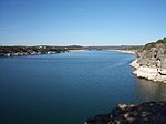 | ||||
| Satellite cities | |||||
| Other communities | |||||
| Counties |
| ||||
| Parks and preserves |
| ||||
| Geography | |||||
| Bodies of water |
| ||||
| Transportation | |||||
| |
|---|---|
Austin (capital) | |
| Topics | |
| Society | |
| Regions |
|
| Metropolitan areas |
|
| Counties | |
 Texas portal Texas portal | |
 | This article related to Austin, Texas is a stub. You can help Wikipedia by expanding it. |
- v
- t
- e
 | This article related to a protected area in Texas is a stub. You can help Wikipedia by expanding it. |
- v
- t
- e


