National Register of Historic Places listings in Posey County, Indiana
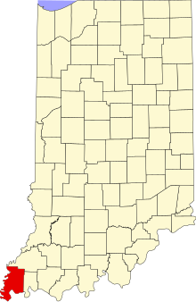
This is a list of the National Register of Historic Places listings in Posey County, Indiana.
This is intended to be a complete list of the properties and districts on the National Register of Historic Places in Posey County, Indiana, United States. Latitude and longitude coordinates are provided for many National Register properties and districts; these locations may be seen together in a map.[1]
There are 18 properties and districts listed on the National Register in the county, including 1 National Historic Landmark. Another 2 properties were once listed but have been removed.
Properties and districts located in incorporated areas display the name of the municipality, while properties and districts in unincorporated areas display the name of their civil township. Properties and districts split between multiple jurisdictions display the names of all jurisdictions.
This National Park Service list is complete through NPS recent listings posted June 28, 2024.[2]
Map all coordinates using OpenStreetMap
Download coordinates as:
- KML
- GPX (all coordinates)
- GPX (primary coordinates)
- GPX (secondary coordinates)
Current listings
| [3] | Name on the Register[4] | Image | Date listed[5] | Location | City or town | Description |
|---|---|---|---|---|---|---|
| 1 | Ashworth Archaeological Site (12 Po 7) | 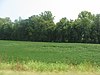 | September 12, 1985 (#85002137) | Eastern side of State Road 69, about 1 mile (1.6 km) north of Hovey Lake[6] 37°51′00″N 87°56′10″W / 37.850000°N 87.936111°W / 37.850000; -87.936111 (Ashworth Archaeological Site (12 Po 7)) | Point Township | An archaeological site of the Caborn-Welborn variant of the Mississippian culture. |
| 2 | George Bentel House |  | September 20, 1984 (#84001224) | Brewery and Granary St. 38°07′50″N 87°55′59″W / 38.130694°N 87.933194°W / 38.130694; -87.933194 (George Bentel House) | New Harmony | |
| 3 | Bozeman-Waters National Bank |  | October 1, 1987 (#87001768) | 19 W. Main St. 38°10′12″N 87°47′02″W / 38.170000°N 87.783889°W / 38.170000; -87.783889 (Bozeman-Waters National Bank) | Poseyville | |
| 4 | James Elliott Farm |  | December 23, 2003 (#03001312) | Church St. (State Road 66), east of New Harmony 38°07′44″N 87°55′23″W / 38.128889°N 87.923056°W / 38.128889; -87.923056 (James Elliott Farm) | Harmony Township | |
| 5 | Ludwig Epple House | 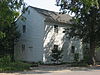 | June 21, 1984 (#84001227) | 520 Granary St. 38°07′50″N 87°56′03″W / 38.130694°N 87.934056°W / 38.130694; -87.934056 (Ludwig Epple House) | New Harmony | |
| 6 | William Gonnerman House |  | December 19, 1985 (#85003192) | 521 W. 2nd St. 37°55′44″N 87°54′02″W / 37.928889°N 87.900556°W / 37.928889; -87.900556 (William Gonnerman House) | Mount Vernon | |
| 7 | Frederick and Augusta Hagemann Farm | 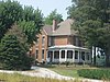 | March 18, 1993 (#93000180) | Southwestern corner of the junction of State Roads 62 and 69, west of Mount Vernon 37°55′35″N 87°54′37″W / 37.926389°N 87.910278°W / 37.926389; -87.910278 (Frederick and Augusta Hagemann Farm) | Black Township | |
| 8 | Harmony Way Bridge |  | October 3, 2007 (#07001030) | Indiana State Road 66/Illinois Route 14 38°07′52″N 87°56′32″W / 38.131111°N 87.942222°W / 38.131111; -87.942222 (Harmony Way Bridge) | New Harmony | Extends into White County, Illinois |
| 9 | Hovey Lake Archaeological District |  | September 12, 1985 (#85002130) | Address Restricted | Point Township | |
| 10 | Mann site |  | October 1, 1974 (#74000018) | Off Indian Mound Rd., southeast of Mount Vernon[7] 37°54′44″N 87°50′20″W / 37.912361°N 87.838889°W / 37.912361; -87.838889 (Mann site) | Black Township | A Hopewell site featuring village areas, geometrical earthworks and mounds. |
| 11 | Mount Vernon Downtown Historic District |  | June 22, 2003 (#03000545) | Roughly bounded by the Ohio River, 6th and Walnut Sts., and College Ave. 37°55′51″N 87°53′46″W / 37.930833°N 87.896111°W / 37.930833; -87.896111 (Mount Vernon Downtown Historic District) | Mount Vernon | |
| 12 | Mount Vernon Site |  | January 11, 1996 (#95001542) | Atop a ridgeline about 100 metres (330 ft) south of County Road 850S, near the entrance to the Mount Vernon General Electric plant and southwest of Mount Vernon[8] 37°54′48″N 87°56′23″W / 37.913333°N 87.939722°W / 37.913333; -87.939722 (Mount Vernon Site) | Black Township | One of the largest known Hopewell mounds. Damaged and looted during discovery in 1988. Also known as the GE Mound. |
| 13 | Murphy Archeological Site |  | May 12, 1975 (#75000012) | Northwestern side of Pitcher Lake, approximately 1 mile (1.6 km) east of the mouth of the Wabash River and southwest of Mount Vernon[9] 37°48′25″N 88°00′05″W / 37.806944°N 88.001389°W / 37.806944; -88.001389 (Murphy Archeological Site) | Point Township | |
| 14 | New Harmony Historic District |  | October 15, 1966 (#66000006) | Main St. between Granary and Church Sts.; also roughly bounded by 3rd, Steammill, Main, Arthur, and North Sts., including the Maple Hill Cemetery and the Atheneum 38°07′48″N 87°56′08″W / 38.13°N 87.935556°W / 38.13; -87.935556 (New Harmony Historic District) | Harmony Township and New Harmony | Second set of boundaries represents a boundary increase of May 3, 2000 |
| 15 | Posey County Courthouse Square |  | January 4, 1989 (#88003042) | 300 Main St. 37°55′55″N 87°53′41″W / 37.931944°N 87.894722°W / 37.931944; -87.894722 (Posey County Courthouse Square) | Mount Vernon | |
| 16 | Mattias Scholle House |  | March 2, 1981 (#81000007) | Tavern and Brewery Sts. 38°07′45″N 87°55′59″W / 38.129167°N 87.933056°W / 38.129167; -87.933056 (Mattias Scholle House) | New Harmony | |
| 17 | Amon Clarence Thomas House |  | September 14, 1995 (#95001111) | 503 West St. 38°07′46″N 87°56′13″W / 38.129583°N 87.936944°W / 38.129583; -87.936944 (Amon Clarence Thomas House) | New Harmony | |
| 18 | Welborn Historic District |  | March 25, 1992 (#92000188) | Roughly bounded by 9th, Locust, and 2nd Sts., and the alley between Walnut and Main Sts. 37°56′03″N 87°53′38″W / 37.934167°N 87.893889°W / 37.934167; -87.893889 (Welborn Historic District) | Mount Vernon |
Former listings
| [3] | Name on the Register | Image | Date listed | Date removed | Location | City or town | Description |
|---|---|---|---|---|---|---|---|
| 1 | I.O.O.F. and Barker Buildings |  | September 12, 1985 (#85002133) | December 25, 2011 | 402-406 Main St. 37°55′56″N 87°53′44″W / 37.932222°N 87.895556°W / 37.932222; -87.895556 (I.O.O.F. and Barker Buildings) | Mount Vernon | |
| 2 | Pitcher House (Fullinwider House) | Upload image | February 8, 1980 (#80000031) | September 14, 1989 | 530 College Ave. 37°55′59″N 87°53′50″W / 37.933055°N 87.897222°W / 37.933055; -87.897222 (Pitcher House (Fullinwider House)) | Mount Vernon | Damaged by fire on September 2, 1983, and subsequently demolished the next month.[10] |
See also
Wikimedia Commons has media related to National Register of Historic Places in Posey County, Indiana.
- List of National Historic Landmarks in Indiana
- National Register of Historic Places listings in Indiana
- Listings in neighboring counties: Gallatin (IL), Gibson, Henderson (KY), Union (KY), Vanderburgh, White (IL)
- List of Indiana state historical markers in Posey County
References
- ^ The latitude and longitude information provided in this table was derived originally from the National Register Information System, which has been found to be fairly accurate for about 99% of listings. Some locations in this table may have been corrected to current GPS standards.
- ^ National Park Service, United States Department of the Interior, "National Register of Historic Places: Weekly List Actions", retrieved June 28, 2024.
- ^ a b Numbers represent an alphabetical ordering by significant words. Various colorings, defined here, differentiate National Historic Landmarks and historic districts from other NRHP buildings, structures, sites or objects.
- ^ "National Register Information System". National Register of Historic Places. National Park Service. March 13, 2009.
- ^ The eight-digit number below each date is the number assigned to each location in the National Register Information System database, which can be viewed by clicking the number.
- ^ Location derived from Adams, William R. Archaeological Notes on Posey County Indiana. Indianapolis: Indiana Historical Bureau, 1949, 70. The NRIS lists the site as "Address Restricted".
- ^ Location derived from Carr, Christopher, and D. Troy Case. Gathering Hopewell: Society, Ritual, and Ritual Interaction. Boston: Birkhäuser, 2005, 555. Accessed 2009-11-16. The NRIS lists the site as "Address Restricted"
- ^ Location derived from United States v. Gerber, 999 F.2d 1112-1117 (7th Cir. 1993), and from Munson, Cheryl Ann, et al. "The GE Mound: An ARPA Case Study". American Antiquity 60.1 (1995): 131-159, 147 and 157. The NRIS lists the site as "Address Restricted".
- ^ Location derived from Bone Bank Archaeological Research, Indiana University Department of Anthropology, 2001-08-06. Accessed 2011-07-28. The NRIS lists the site as "Address Restricted".
- ^ "Fire damages historic home". Evansville Courier & Press. September 3, 1983. p. 13. Retrieved June 22, 2022 – via Newspapers.com.
- v
- t
- e
- List of U.S. National Historic Landmarks by state:
- Alabama
- Alaska
- Arizona
- Arkansas
- California
- Colorado
- Connecticut
- Delaware
- Florida
- Georgia
- Hawaii
- Idaho
- Illinois
- Indiana
- Iowa
- Kansas
- Kentucky
- Louisiana
- Maine
- Maryland
- Massachusetts
- Michigan
- Minnesota
- Mississippi
- Missouri
- Montana
- Nebraska
- Nevada
- New Hampshire
- New Jersey
- New Mexico
- New York
- North Carolina
- North Dakota
- Ohio
- Oklahoma
- Oregon
- Pennsylvania
- Rhode Island
- South Carolina
- South Dakota
- Tennessee
- Texas
- Utah
- Vermont
- Virginia
- Washington
- West Virginia
- Wisconsin
- Wyoming
 National Register of Historic Places portal
 Category


