Carnlough

Cet article est une ébauche concernant l’Irlande du Nord.
Vous pouvez partager vos connaissances en l’améliorant (comment ?) selon les recommandations des projets correspondants.
Carnlough
| ||||
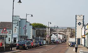 Route Harbour, Carnlough, comté d'Antrim | ||||
| Administration | ||||
|---|---|---|---|---|
| Pays |  Royaume-Uni Royaume-Uni | |||
| Nation | Irlande du Nord | |||
| Comté | Antrim | |||
| Statut | Village | |||
| Code postal | BT44 | |||
| Indicatif | 028 | |||
| Démographie | ||||
| Population | 2 084 hab. (2016) | |||
| Densité | 2 956 hab./km2 | |||
| Géographie | ||||
| Coordonnées | 54° 59′ 25″ nord, 5° 59′ 33″ ouest | |||
| Altitude | 3 m | |||
| Superficie | 70,5 ha = 0,705 km2 | |||
| Localisation | ||||
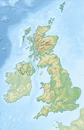
| Géolocalisation sur la carte : Royaume-Uni
Géolocalisation sur la carte : Royaume-Uni
Géolocalisation sur la carte : Irlande du Nord
| ||||
modifier  | ||||


Carnlough est un village côtier de 2 084 habitants dans le comté d'Antrim en Irlande du Nord[1]. Pour une grande majorité de ses habitants Londres est loin, et la république d'Irlande leur idéal. Un petit drapeau irlandais flotte d'ailleurs au mât de la baie côtière.
Références
- ↑ (en) « NINIS: Northern Ireland Neighbourhood Information Service », sur nisra.gov.uk, (consulté le )
 Portail de l’Irlande du Nord


